
Balloon Navigator
To select a waypoint, click on it on the map. Selected data panel will open. You can show/hide it with S key.
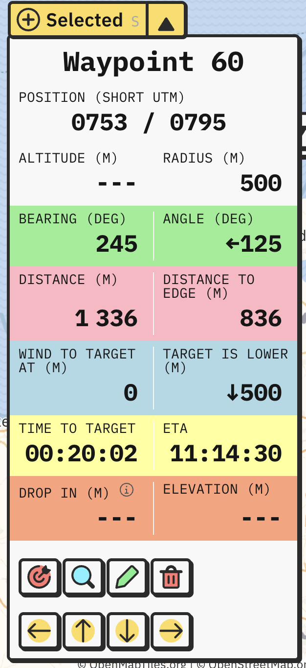
Panel will show various navigation details for selected waypoint. At the top, there is a name, description, coordinates, altitude and radius (if circle).
Blue panels show data related to air. Green are headings, red are speed and distances, yellow are time. Orange are ground related.
Distance to target is different based on waypoint type. For Points and Circles, distance is measured to the center of waypoint (right on Point or middle of circle). Circle has additional metric distance to edge which displays closest distance to reach its radius. For Polygon, Line and Freehand, distance is measured to the closest point of the shape.
Descent/Ascent to target tells you how fast you have to ascent or descent to reach target precisely at its altitude, based on your speed, distance and altitude difference. This field shows only when waypoint has known altitude or elevation.
Buttons at the bottom are:
Quickly move selected waypoint on the map with arrow keys.